Share this article

NeighborSpace is proud to present its final report on the historical role of Bear Creek and its people. Principal investigator Dr. Glenn Johnston worked for more than two years with a team of professional historians, community historians, and Stevenson University students to analyze military operations during the War of 1812 and to document the natural and cultural landscape of Patapsco Neck leading up to the War. The full report can be accessed here and print copies will be available for loan soon. Highlights of the study are summarized in these pages.

Significant outcomes of the team’s research include an improved and altered understanding of the role of Bear Creek in the defense of Baltimore. Original documents provide evidence that Bear Creek was a piece of key terrain and contributed significantly to the Battle of Patapsco Neck and the land defense of the port of Baltimore. Bear Creek served both as an avenue of approach for the British barges to attack the Americans and as a logistical transportation route for British forces during their attack. A limited but significant engagement at Lower Bear Creek slowed, if not stopped, the British advance. These findings confirm what community members have long thought to be true. Bear Creek was part of the battlefield on which engagements were fought and operations conducted as part of the defense of the port of Baltimore in 1814, and the people of Patapsco Neck were widely represented on its field of battle or performing supporting duties as civilians.

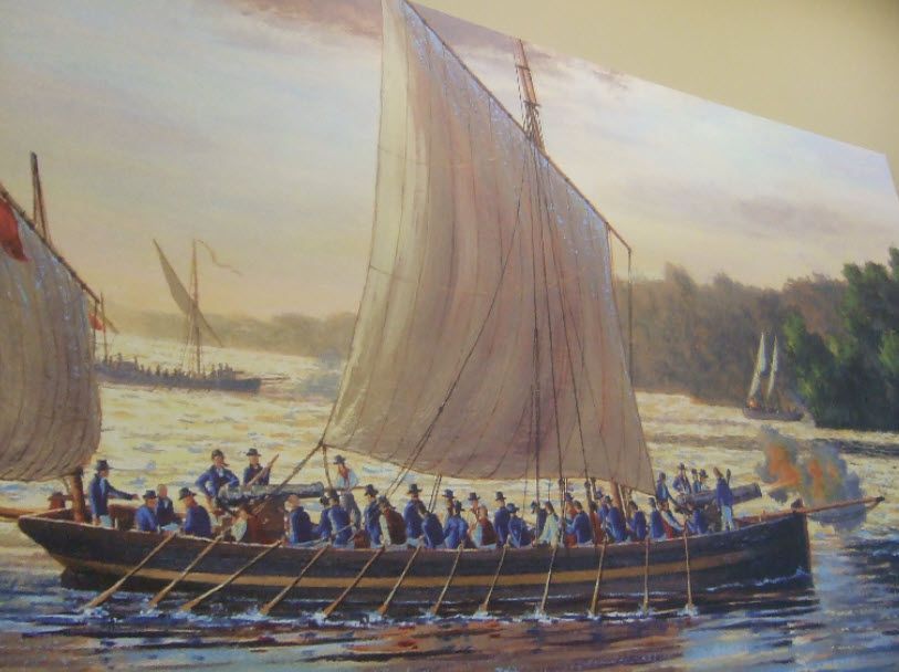
Gunboats, or barges as they were called at the time, like the one above were used by both the American and British navies during the War of 1812. A number of British gunboats and armed barges entered Bear Creek at 1:00 PM on September 14, 1814, and engaged about 500 American riflemen on Sollers Point, approximately an hour before the beginning of the Battle of Patapsco Neck. (Art by Peter Rindlisbacher)
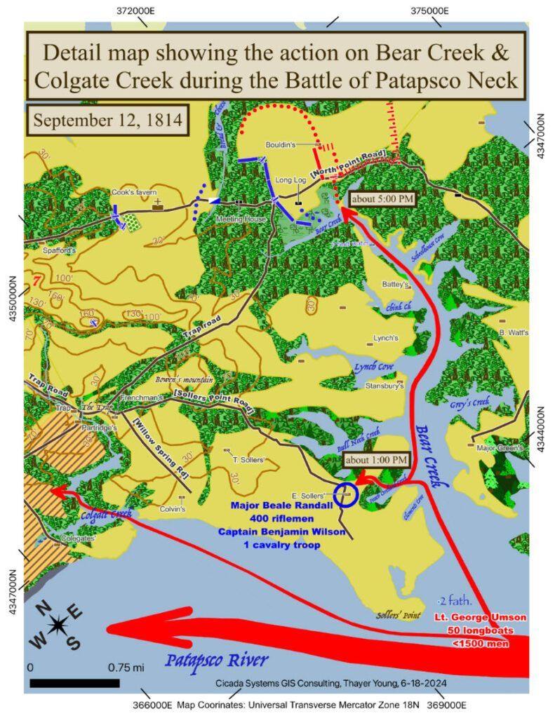
A map of a portion of Patapsco Neck, including Bear Creek and Colgate Creek and the battleground at Bear Creek’s head. The red arrows show the main British force moving up the Patapsco toward Fort McHenry at about 1:00 PM on the 12 th , the barge division that attacked Sollers Point and eventually went to the head of the creek, as well as the barge division that attacked into Colgate Creek.
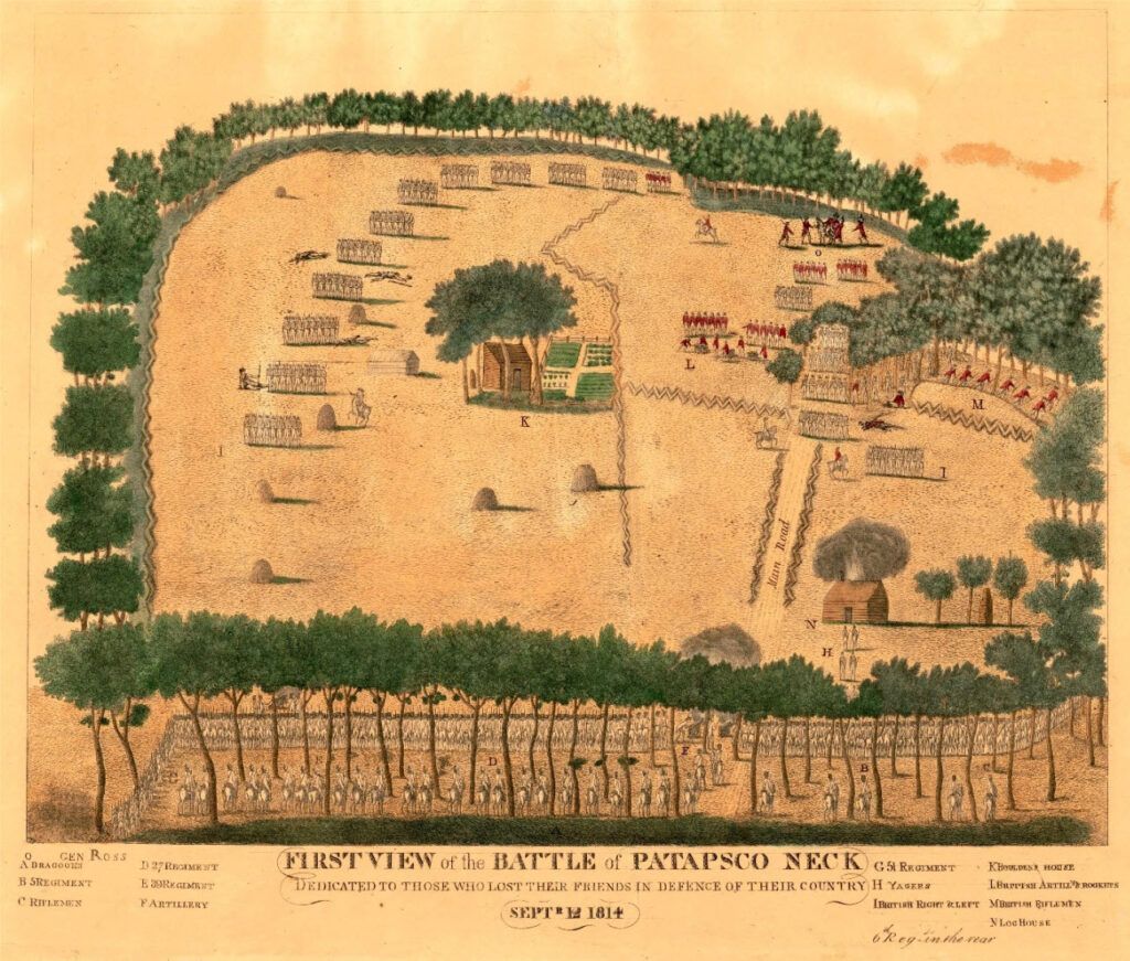
“Image of the First View of the Battle of Patapsco Neck” by Andrew Duluc (circa 1814).  A participant in the battle, Duluc was a member of the Baltimore Jaegers. This engraved work was first advertised in a newspaper on September 28, 1814 just two weeks after the battle. The engraving is thought to have been done by John Bower.  At the bottom of the view, the Maryland militia face the British who are assaulting the American center. On the upper right, British skirmishers rush into the trees near the bank at the head of Bear Creek. (Licensed by Alamy.)

While a study of the Patapsco Neck community was difficult due to the fact that in those times data was gathered for a larger administrative unit (the lower Patapsco Hundred), the research team was able to make the following observations:

  • Women were marginalized at the time of the War of 1812 and little evidence of their lives exists. However, the research team was able to develop narratives for three prominent women.

  • Native American encampments have been documented in the vicinity of present-day North Point State Park and Bear Creek, and North Point very likely runs along an old Native American trail.

  • Many more African Americans lived in the Lower Patapsco Hundred than initially thought. Of the total population recorded in the 1810 census (2,670), 38% were African Americans. Of those residents, only 43% were free, accounting for 51 families. Most of these free Black families lived in six clusters in the Lower Patapsco Hundred.

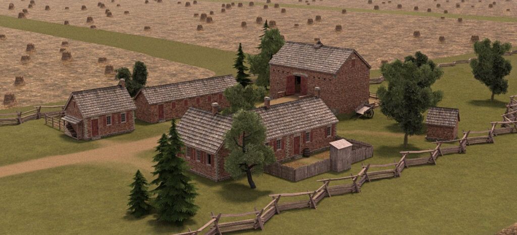
An artist’s concept of the Soller homestead in 1814.  Based on very specific descriptions and measurements of the farm buildings from the 1798 Federal Direct Tax Assessment and the Congressional compensation claim descriptions, artist Matt Root could envision this farm rendering.

Unsurprisingly, the natural landscape of Patapsco Neck looked very different at the time of the War of 1812. Much of the area, possibly as much as 50%, consisted of unimproved tree-covered lands. An officer present in the British advance observed that

“The high road wound for many miles through the center of a dark forest; and the course of the flankers was rarely indeed diversified with any other prospect, besides that of an apparently interminable wilderness of trees”.

Today, very little of that green space remains in the Dundalk area, and public access to the waterfront is especially limited. The Bear Creek Heritage Trail will not only share the above history with the public but will provide the community with access to green space along the waterfront. NeighborSpace is currently working with Brenton Landscape Architecture to design Phase 3 of the trail.

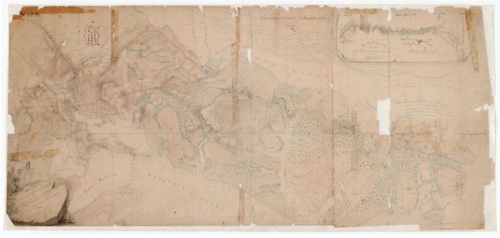
Top: An 1818 drawing of Patapsco Neck done by Major James Kearney, based on the reconnaissance report of Major William Barney and his cavalrymen.
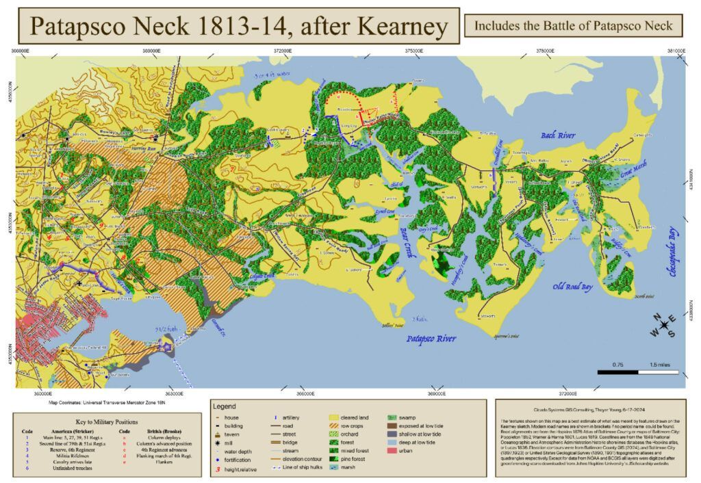
Bottom: The Kearney Map redone on a modern datum representing the actual geography of Patapsco Neck, by Thayer Young.
Recent Posts

By Will Kaselow August 10, 2026
Live Music and Ribbon Cutting at Graystone 7/28/26 | Will Kaselow, Community Conservation Manager
By Will Kaselow July 29, 2026
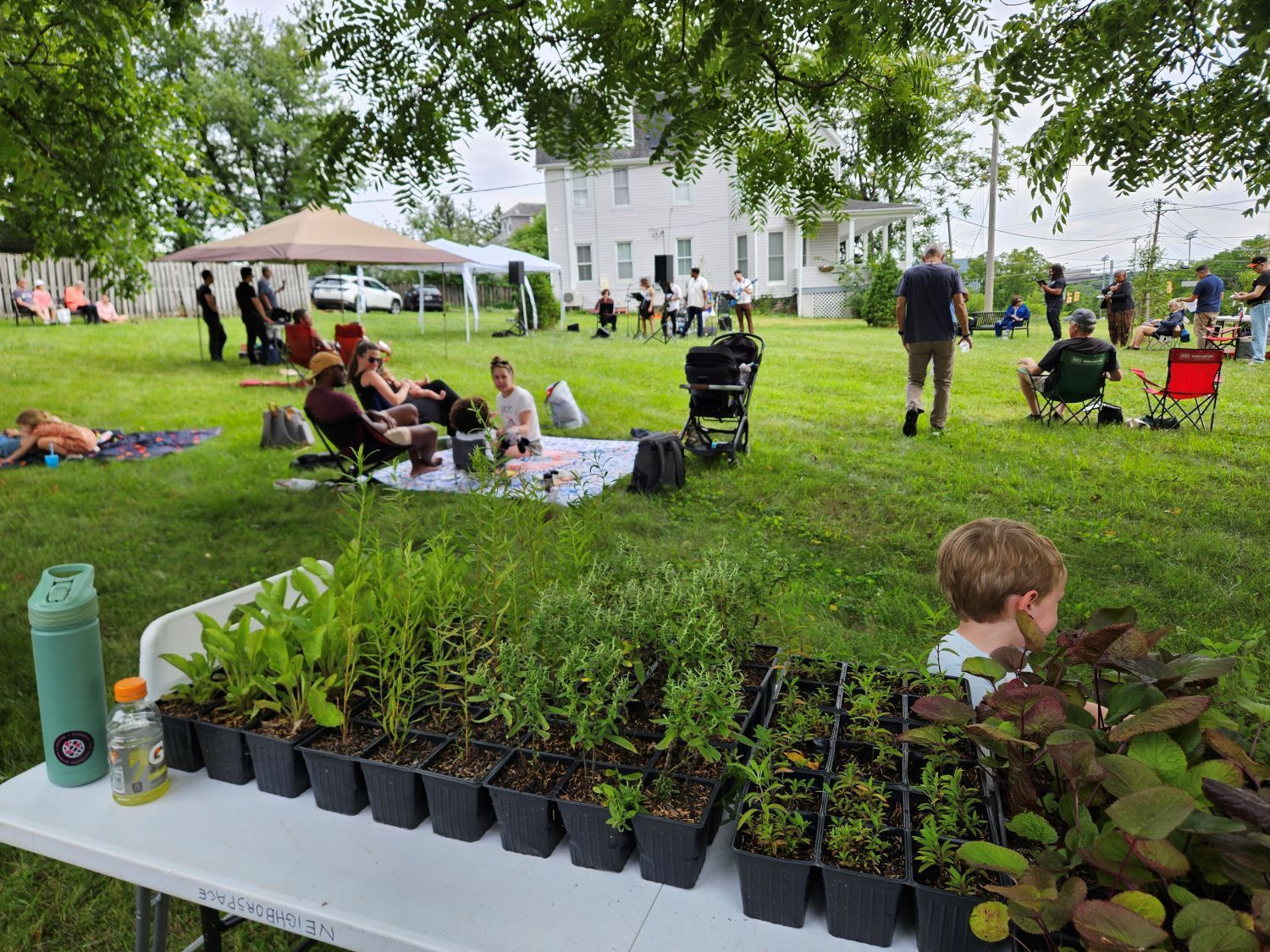
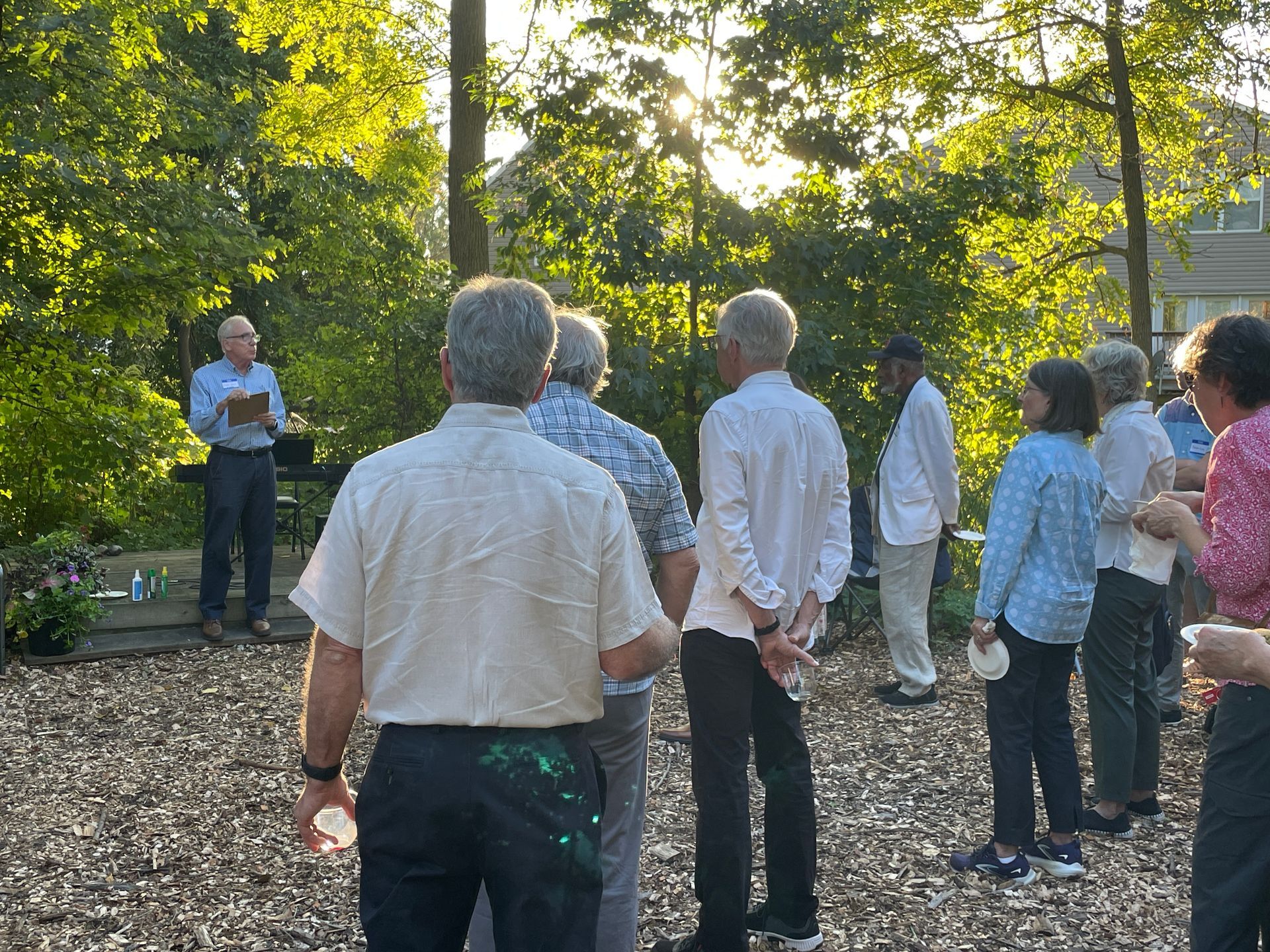
7/28/26 | Will Kaselow, Community Conservation Manager Thank you to everyone who came out to NeighborSpace’s final concert of the summer! After the original date was cancelled due to wildfire-related air pollution, we were able to quickly reschedule and ended up lucking into one of the most beautiful nights of the summer so far. We […]
By Phyllis Joris July 29, 2026
7/29/2026 | Phyllis Joris, Executive Director Like many nonprofits, NeighborSpace operates on a fiscal year that runs July through June. This month, NeighborSpace staff and board members took stock of progress made in the past year and drafted a work plan for the coming year. More details will be provided in NeighborSpace’s Annual Report, which […]
By Carol Partonen July 29, 2026
Thanks to donations from generous supporters like you, NeighborSpace was able to hire three interns this summer. We want to help young conservationists gain fieldwork and behind-the-scenes experience, and staff is grateful for the extra hands and minds! We introduced you to our stewardship interns last month.Now read on to meet our communications intern, Mykiah. […]
By Carol Partonen July 28, 2026
Barbara Waters While I grew up in Massachusetts and then spent 6 years in Northern Maine, I have now lived in Maryland for nearly 32 years. I had been involved in many things in the community, but that involvement really ramped up once the pandemic started. To combat isolation, I started walking daily, and have […]
By Carol Partonen June 29, 2026
Thanks to donations from generous supporters like you, NeighborSpace was able to hire three interns this summer. We want to help young conservationists gain fieldwork and behind-the-scenes experience, and staff is grateful for the extra hands and minds! Read on to meet our two stewardship interns, Ashley and Katie. Hi! I am Ashley Metzbower. I […]
By Will Kaselow June 29, 2026
6/29/26 | Will Kaselow, Community Conservation Manager This month we welcomed the summer with song, hosting live music events at two of our sites! First, Patrick Alban and his Buena Vista Social Club joined us at Ridgely Manor Park in Towson on one of the hottest nights of the year so far. Despite the heat, […]
By Conor Harrington June 29, 2026
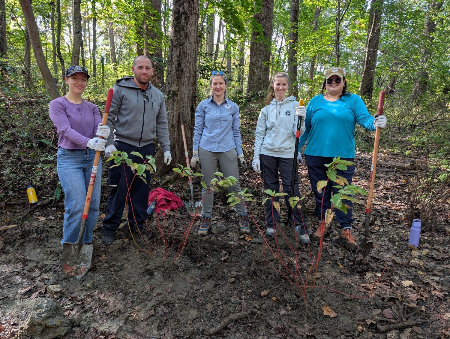
6/29/26 | Conor Harrington, Land Steward This spring, NeighborSpace installed its first microforest/Miyawaki plantings at Tollgate Wyndham Preserve in Owings Mills. With the help of some very dedicated volunteer groups from BGE and Stanley Black & Decker, we planted about 150 trees and shrubs in three contained locations of the preserve. The area covered by […]
By Phyllis Joris June 29, 2026
6/29/2026 | Phyllis Joris, Executive Director NeighborSpace recently added a new site to its portfolio! With the addition of Stonegate, a beautiful 16-acre property in Catonsville, NeighborSpace now protects 116 acres across 22 sites for current and future residents of urban Baltimore County. This property is co-held with Maryland Environmental Trust (MET), the state’s land […]
By Will Kaselow May 29, 2026
This month we would like to thank Christie Bianco for her time and dedication as a NeighborSpace volunteer! Christie has lived in the Dunmore community for 21 years and first connected with Levickas Woods through her children, who would play in the woods and catch crayfish in the stream. She considers the woods to be […]
Show More